Articles, war diaries, and recognition to the Men of the "Fighting 18th"
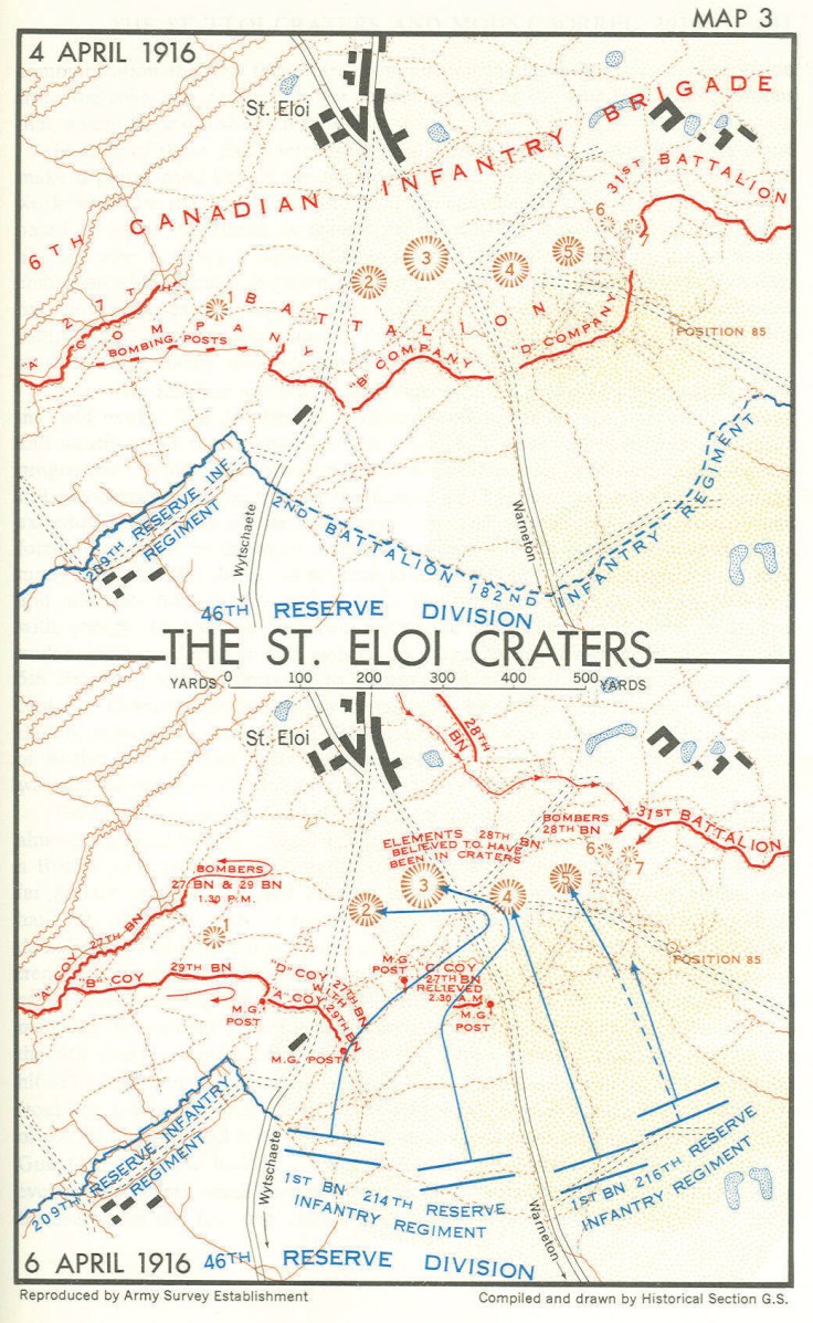
St. Eloi Maps and Images
Map of St Eloi with the six mines fired on 27 March 1916.Source: http://bit.ly/2UqcS3g
The Canadian positions as of April 10, 1916.
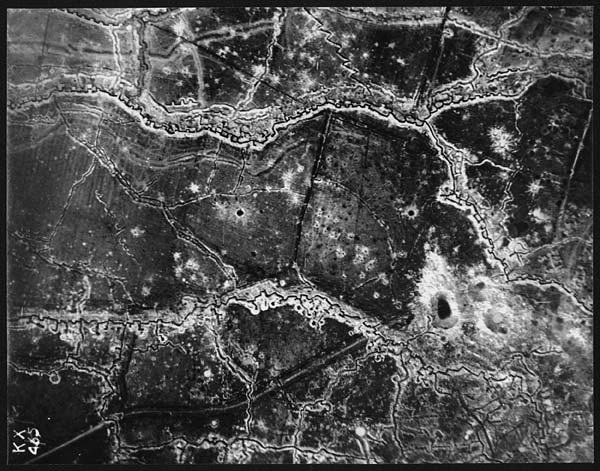
Aeriel reconnasance photograph of the St. Eloi Craters.Aeriel reconnasance photograph of the St. Eloi Craters.Aeriel reconnasance photograph of the St. Eloi Craters.One of the craters at St. Eloi. Canada. Dept. of National Defence-Library and Archives Canada-PA-004394.